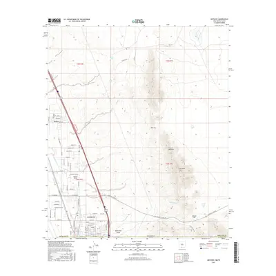
2017 Map of Anthony
USGS Topo · Published 2017About this map
Anthony straddles the high-desert borderlands where the Franklin Mountains meet the agricultural plains of the Mesilla Valley. This 2017 study illustrates a landscape defined by the sharp contrast between the arid peaks of N Anthonys Nose and the intricate irrigation network of the Anthony Lateral and East Drain to the west. The border itself is a dominant feature, with the New Mexico-Texas line cutting through the heart of the settlement, placing Hacienda Acres and the Old Berino Cem in New Mexico while the eastern slopes remain in Texas.
Find a feature on this map
61 named features on this map. Tap any name to fly to it.
Don’t see what you’re looking for? This feature index may not catch every label — zoom into the map to look around manually.
Map Details
Editions of this 2017 Anthony Map
This is the sole edition of this map. No revisions or reprints were ever made.
Other maps of this area

1891 · Las Cruces
USGS Topo · 1:125,000

1893 · Las Cruces
USGS Topo · 1:125,000

1896 · El Paso
USGS Topo · 1:125,000

1908 · El Paso
USGS Topo · 1:125,000

1917 · Canutillo
USGS Topo · 1:62,500

1919 · Canutillo
USGS Topo · 1:62,500

1940 · Newman
USGS Topo · 1:62,500

1942 · Fort Bliss
USGS Topo · 1:62,500

1943 · La Mesa
USGS Topo · 1:62,500

1943 · Newman
USGS Topo · 1:62,500