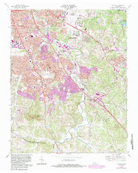
1968 Map of Antioch
USGS Topo · Published 1984About this map
Antioch and the surrounding Davidson County suburbs appear here in a state of rapid transition during the late 1960s, with extensive urban revisions added in the early 1980s. The landscape is defined by the winding course of Mill Creek and the heavy infrastructure of the Seaboard railroad and Murfreesboro Road. Significant institutional presence is marked by the Middle Tennessee Mental Health Institute and several schools like Glencliff High Sch.
Find a feature on this map
50 named features on this map. Tap any name to fly to it.
Don’t see what you’re looking for? This feature index may not catch every label — zoom into the map to look around manually.
Map Details
Editions of this 1968 Antioch Map
4 editions found
Other maps of this area

1903 · Nashville
USGS Topo · 1:125,000

1909 · Franklin
USGS Topo · 1:62,500

1932 · Hermitage
USGS Topo · 1:62,500

1932 · Nashville
USGS Topo · 1:62,500

1942 · Lebanon
USGS Topo · 1:100,000

1949 · Franklin
USGS Topo · 1:24,000

1952 · Hermitage
USGS Topo · 1:24,000

1952 · Nashville West
USGS Topo · 1:24,000

1952 · La Vergne
USGS Topo · 1:24,000

1952 · Nashville East
USGS Topo · 1:24,000