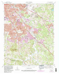
1968 Map of Antioch
USGS Topo · Published 1987About this map
Antioch and the surrounding suburban expansion of southeast Davidson County are captured during a period of rapid infrastructure development. The drainage of Mill Creek and its many tributaries, including Creek and Collins Creek, structures the landscape as residential neighborhoods like Tusculum, Whispering Hills, and Glencliff fill the space between established transportation corridors. The arrival of the interstate system is prominent, featuring Interchange 54 and Interchange 56, which alongside the Seaboard railroad, signal the area's transition into a modern commuter hub.
Find a feature on this map
68 named features on this map. Tap any name to fly to it.
Don’t see what you’re looking for? This feature index may not catch every label — zoom into the map to look around manually.
Map Details
Editions of this 1968 Antioch Map
4 editions found
Other maps of this area

1903 · Nashville
USGS Topo · 1:125,000

1909 · Franklin
USGS Topo · 1:62,500

1932 · Hermitage
USGS Topo · 1:62,500

1932 · Nashville
USGS Topo · 1:62,500

1942 · Lebanon
USGS Topo · 1:100,000

1949 · Franklin
USGS Topo · 1:24,000

1952 · Hermitage
USGS Topo · 1:24,000

1952 · Nashville West
USGS Topo · 1:24,000

1952 · La Vergne
USGS Topo · 1:24,000

1952 · Nashville East
USGS Topo · 1:24,000