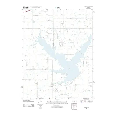
2010 Map of Antioch
USGS Topo · Published 2010About this map
Hillsdale Lake dominates this 2010 landscape, its multi-fingered shoreline reaching into the agricultural lands south of Antioch. The map records a transition from traditional rural farmsteads to modern recreation and transportation, evidenced by the proximity of Hayden Farm Airport to the growing network of paved routes like Gardner Rd and Tontzville Rd. Waterways that once defined property lines and drainage, such as Bull Creek and Scott Branch Bull Creek, are now largely integrated into the reservoir system.
Find a feature on this map
42 named features on this map. Tap any name to fly to it.
Don’t see what you’re looking for? This feature index may not catch every label — zoom into the map to look around manually.
Map Details
Editions of this 2010 Antioch Map
This is the sole edition of this map. No revisions or reprints were ever made.
Other maps of this area

1885 · Lawrence
USGS Topo · 1:125,000

1887 · Olathe
USGS Topo · 1:125,000

1889 · Lawrence
USGS Topo · 1:125,000

1893 · Olathe
USGS Topo · 1:125,000

1947 · Lawrence
USGS Topo · 1:250,000

1950 · Lawrence
USGS Topo · 1:250,000

1956 · Wellsville
USGS Topo · 1:24,000
1956 · Ocheltree
USGS Topo · 1:24,000

1956 · Paola East
USGS Topo · 1:24,000
1956 · Edgerton
USGS Topo · 1:24,000