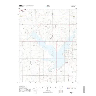
2018 Map of Antioch
USGS Topo · Published 2018About this map
Antioch and the surrounding borderlands between Johnson and Miami counties are defined by the intricate dendritic drainage of Bull Creek and its many tributaries. This landscape, as it appeared in 2018, reveals a transition from the established street grid of Edgerton in the northwest to a more dispersed agricultural and rural residential pattern to the south and east. The map provides significant detail for genealogists, documenting several burial grounds including Antioch Cem, Scotts Valley Cem, and the Marysville Cem - Old.
Find a feature on this map
65 named features on this map. Tap any name to fly to it.
Don’t see what you’re looking for? This feature index may not catch every label — zoom into the map to look around manually.
Map Details
Editions of this 2018 Antioch Map
This is the sole edition of this map. No revisions or reprints were ever made.
Other maps of this area

1885 · Lawrence
USGS Topo · 1:125,000

1887 · Olathe
USGS Topo · 1:125,000

1889 · Lawrence
USGS Topo · 1:125,000

1893 · Olathe
USGS Topo · 1:125,000

1947 · Lawrence
USGS Topo · 1:250,000

1950 · Lawrence
USGS Topo · 1:250,000

1956 · Wellsville
USGS Topo · 1:24,000
1956 · Ocheltree
USGS Topo · 1:24,000

1956 · Paola East
USGS Topo · 1:24,000
1956 · Edgerton
USGS Topo · 1:24,000