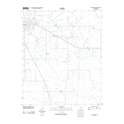
2010 Map of Antlers East
USGS Topo · Published 2010About this map
Antlers sits at the western edge of this landscape, where the street grid of the town center gives way to the dispersed rural communities of Pushmataha County. The Kiamichi River winds across the northeastern corner, its drainage system fed by numerous creeks including Beaver Creek and Dumpling Creek. This area shows a pattern of small settlements such as East Town Village, Ethel, and Dela connected by a network of local roads and the modern Indian Nation Turnpike. Genealogists will find notable burial sites like the Odd Fellows Cemetery near the main town and the White Church Cemetery further east. The terrain is marked by specific natural and man-made landmarks, from the elevation of Big Rocks to the engineered structure of the Oknoname 127006 Dam, illustrating the late-20th-century development of water management and local infrastructure in this part of Oklahoma.
Find a feature on this map
39 named features on this map. Tap any name to fly to it.
Don’t see what you’re looking for? This feature index may not catch every label — zoom into the map to look around manually.
Map Details
Editions of this 2010 Antlers East Map
This is the sole edition of this map. No revisions or reprints were ever made.
Other maps of this area

1901 · Antlers
USGS Topo · 1:125,000

1901 · Alikchi
USGS Topo · 1:125,000

1912 · Antlers
USGS Topo · 1:125,000

1925 · Antlers
USGS Topo · 1:125,000

1950 · Mcalester
USGS Topo · 1:250,000

1957 · Moyers
USGS Topo · 1:24,000

1961 · Antlers East
USGS Topo · 1:24,000

1961 · Antlers West
USGS Topo · 1:24,000

1962 · McAlester
USGS Topo · 1:250,000

1965 · McAlester
USGS Topo · 1:250,000