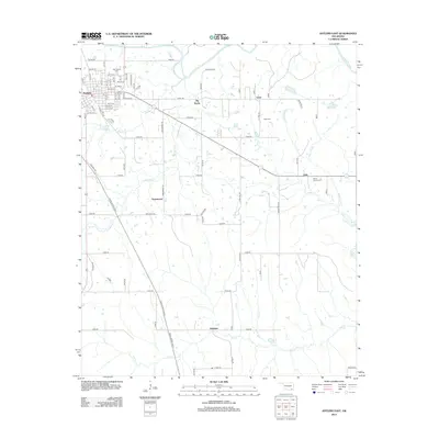
2013 Map of Antlers East
USGS Topo · Published 2013About this map
Antlers serves as the regional hub in this part of Pushmataha County, positioned where local streets like NE 9th St and N High St transition into the rural section-line road network. The landscape is defined by the winding course of the Kiamichi River in the northeast and numerous tributaries such as Beaver Cr and Dumpling Cr that drain the territory. Small rural communities and named locales including Ethel, Greenwood, Dela, and Hamden are spread across the township, connected by a grid of numbered routes like E1930 Rd. Genealogists will find significant local history at the Odd Fellows Cem, Ethel Cem, and White Church Cem, which anchor these long-standing settlements. The massive Indian Nation Turnpike cuts a modern diagonal across the terrain, contrasting with the older topography of the Big Rocks area.
Find a feature on this map
73 named features on this map. Tap any name to fly to it.
Don’t see what you’re looking for? This feature index may not catch every label — zoom into the map to look around manually.
Map Details
Editions of this 2013 Antlers East Map
This is the sole edition of this map. No revisions or reprints were ever made.
Other maps of this area

1901 · Antlers
USGS Topo · 1:125,000

1901 · Alikchi
USGS Topo · 1:125,000

1912 · Antlers
USGS Topo · 1:125,000

1925 · Antlers
USGS Topo · 1:125,000

1950 · Mcalester
USGS Topo · 1:250,000

1957 · Moyers
USGS Topo · 1:24,000

1961 · Antlers East
USGS Topo · 1:24,000

1961 · Antlers West
USGS Topo · 1:24,000

1962 · McAlester
USGS Topo · 1:250,000

1965 · McAlester
USGS Topo · 1:250,000