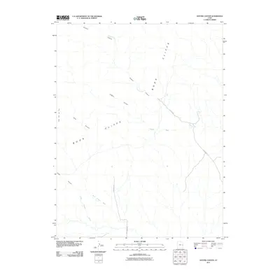
2011 Map of Antone Canyon
USGS Topo · Published 2011About this map
The Book Cliffs dominate this eastern Utah landscape, forming a massive geological escarpment that dictates the flow of every drainage in the region. This 2011 survey by the U.S. Geological Survey documents the remote network of canyons and washes that carve through the high plateau, including Antone Canyon and Sulphur Canyon. The area is defined by its deep vertical relief and the critical access points provided by Sulphur Rd and Cottonwood Rd.
Find a feature on this map
12 named features on this map. Tap any name to fly to it.
Don’t see what you’re looking for? This feature index may not catch every label — zoom into the map to look around manually.
Map Details
Editions of this 2011 Antone Canyon Map
This is the sole edition of this map. No revisions or reprints were ever made.
Other maps of this area

1885 · East Tavaputs
USGS Topo · 1:250,000

1954 · Westwater 4 SW
USGS Topo · 1:24,000

1956 · Grand Junction
USGS Topo · 1:250,000

1959 · Grand Junction
USGS Topo · 1:250,000

1960 · Grand Junction
USGS Topo · 1:250,000

1962 · Grand Junction
USGS Topo · 1:250,000

1964 · Grand Junction
USGS Topo · 1:250,000

1965 · Grand Junction
USGS Topo · 1:250,000
1970 · Harley Dome
USGS Topo · 1:24,000

1970 · Flume Canyon
USGS Topo · 1:24,000