
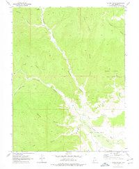
1970 Map of Flume Canyon
USGS Topo · Published 1973About this map
The Book Cliffs dominate this portion of Grand County, Utah, where deep drainage systems like Diamond Canyon and Flume Canyon carve through the high desert plateau. By the early 1970s, the landscape reflected a transition from traditional ranching toward energy extraction. Evidence of early resource exploration is seen in the Cisco Springs North Gas Field and scattered drill holes, while a corral and ford near the convergence of Cottonwood Canyon and Diamond Canyon suggest continued livestock movement. A network of jeep trails and older trails provides the primary access through this complex topography, connecting remote water sources like Oak Springs and unnamed springs tucked into the side canyons. The presence of Coal Canyon and Antone Canyon further emphasizes the mineral-focused nomenclature of this canyon-dissected terrain.
Find a feature on this map
19 named features on this map. Tap any name to fly to it.
Don’t see what you’re looking for? This feature index may not catch every label — zoom into the map to look around manually.
Map Details
Editions of this 1970 Flume Canyon Map
3 editions found
Other maps of this area

1885 · East Tavaputs
USGS Topo · 1:250,000

1956 · Grand Junction
USGS Topo · 1:250,000

1959 · Grand Junction
USGS Topo · 1:250,000

1960 · Grand Junction
USGS Topo · 1:250,000

1962 · Grand Junction
USGS Topo · 1:250,000

1963 · Tenmile Canyon
USGS Topo · 1:62,500

1963 · Sego Canyon
USGS Topo · 1:62,500

1964 · Grand Junction
USGS Topo · 1:250,000

1965 · Grand Junction
USGS Topo · 1:250,000
1970 · Preacher Canyon
USGS Topo · 1:24,000