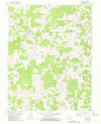
1981 Map of Anutt
USGS Topo · Published 1981About this map
Anutt serves as the primary community hub in this upland region of Dent County during the late 1970s. The landscape is defined by a dense network of small family and community cemeteries, including Bingham Cem, Karns Cem, and Edgar Cem, which reflect the deep-rooted genealogical history of the surrounding Watkins and Norman townships. These burial sites are frequently positioned near small drainages such as Porter Creek and Horse Creek.
Find a feature on this map
34 named features on this map. Tap any name to fly to it.
Don’t see what you’re looking for? This feature index may not catch every label — zoom into the map to look around manually.
Map Details
Editions of this 1981 Anutt Map
This is the sole edition of this map. No revisions or reprints were ever made.
Other maps of this area

1912 · Rolla
USGS Topo · 1:62,500

1928 · Meramec Spring
USGS Topo · 1:62,500

1937 · Edgar Springs
USGS Topo · 1:48,000

1941 · Salem
USGS Topo · 1:62,500

1945 · Salem
USGS Topo · 1:62,500

1945 · Edgar Springs
USGS Topo · 1:62,500

1949 · Rolla
USGS Topo · 1:250,000

1949 · Meramec Spring
USGS Topo · 1:62,500
1950 · Yancy Mills
USGS Topo · 1:24,000
1951 · Yancy Mills
USGS Topo · 1:24,000