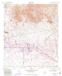
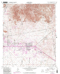
1956 Map of Apache Junction
USGS Topo · Published 1983About this map
Apache Junction serves as the hub of this 1950s Arizona landscape, positioned at the convergence of historic desert routes. The map illustrates a transitional era where traditional ranching and mining terrain met the early growth of residential developments and seasonal retreats, evidenced by numerous trailer parks and the Superstition Mtn School. To the north, the terrain rises sharply into the Goldfield Mountains and the Tonto National Forest, where the Bulldog Mine and scattered prospects suggest the area's mineral-driven past.
Find a feature on this map
33 named features on this map. Tap any name to fly to it.
Don’t see what you’re looking for? This feature index may not catch every label — zoom into the map to look around manually.
Map Details
Editions of this 1956 Apache Junction Map
5 editions found
Other maps of this area

1900 · Florence
USGS Topo · 1:125,000

1902 · Florence
USGS Topo · 1:125,000

1904 · Desert Well
USGS Topo · 1:62,500

1904 · Ft. McDowell
USGS Topo · 1:62,500

1906 · Ft. McDowell
USGS Topo · 1:62,500

1906 · Desert Well
USGS Topo · 1:62,500

1907 · Roosevelt
USGS Topo · 1:125,000

1909 · Four Peaks
USGS Topo · 1:125,000

1912 · Roosevelt
USGS Topo · 1:125,000

1930 · Cave Creek
USGS Topo · 1:125,000