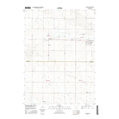
2015 Map of Aplington
USGS Topo · Published 2015About this map
Aplington and the smaller settlement of Austinville serve as the primary hubs in this agricultural landscape straddling the Butler and Grundy County line. The terrain is defined by the winding course of Beaver Creek and its various tributaries, including Gran Cr and N Fork S Beaver Cr, which carve gentle valleys through the prairie grid. For genealogists and local historians, several rural burial sites are documented across the townships, such as Saint Peter's Evangelical Cem in the south and Pleasant View Cem to the east. The map's layout reflects a deeply established section-line road system, with named thoroughfares like Parriott St and Grand Ave connecting isolated farmsteads and the central community of Aplington, where a tight residential grid is established around Howard St and Gray St.
Find a feature on this map
53 named features on this map. Tap any name to fly to it.
Don’t see what you’re looking for? This feature index may not catch every label — zoom into the map to look around manually.
Map Details
Editions of this 2015 Aplington Map
This is the sole edition of this map. No revisions or reprints were ever made.
Other maps of this area

1954 · Waterloo
USGS Topo · 1:250,000

1955 · Waterloo
USGS Topo · 1:250,000

1979 · Holland
USGS Topo · 1:24,000

1979 · Ackley NE
USGS Topo · 1:24,000

1979 · Ackley
USGS Topo · 1:24,000

1979 · Steamboat Rock
USGS Topo · 1:24,000

1979 · Dumont South
USGS Topo · 1:24,000

1979 · Butler Center
USGS Topo · 1:24,000

1980 · Aplington
USGS Topo · 1:24,000

1980 · Wellsburg
USGS Topo · 1:24,000