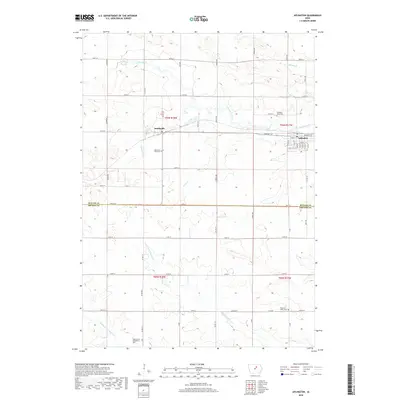
2018 Map of Aplington
USGS Topo · Published 2018About this map
Aplington serves as the primary hub in this portion of the Iowa countryside, situated at the junction of the Butler and Grundy county lines. The landscape is defined by the meandering course of Beaver Creek and its many tributaries, including Kilsons Br and Gran Cr. The settlement of Austinville sits to the west, while the surrounding rural townships are dotted with several small cemeteries that reflect the area's genealogical history. These include Memorial Park Cem, Pleasant View Cem, and the Saint Peter's Evangelical Cem located further south near the Middle Fork S Beaver Cr. The map preserves the geometric precision of the township and range system, with gravel roads like 340th St and W Ridge following the section lines across the agricultural terrain.
Find a feature on this map
34 named features on this map. Tap any name to fly to it.
Don’t see what you’re looking for? This feature index may not catch every label — zoom into the map to look around manually.
Map Details
Editions of this 2018 Aplington Map
This is the sole edition of this map. No revisions or reprints were ever made.
Other maps of this area

1954 · Waterloo
USGS Topo · 1:250,000

1955 · Waterloo
USGS Topo · 1:250,000

1979 · Holland
USGS Topo · 1:24,000

1979 · Ackley NE
USGS Topo · 1:24,000

1979 · Ackley
USGS Topo · 1:24,000

1979 · Steamboat Rock
USGS Topo · 1:24,000

1979 · Dumont South
USGS Topo · 1:24,000

1979 · Butler Center
USGS Topo · 1:24,000

1980 · Aplington
USGS Topo · 1:24,000

1980 · Wellsburg
USGS Topo · 1:24,000