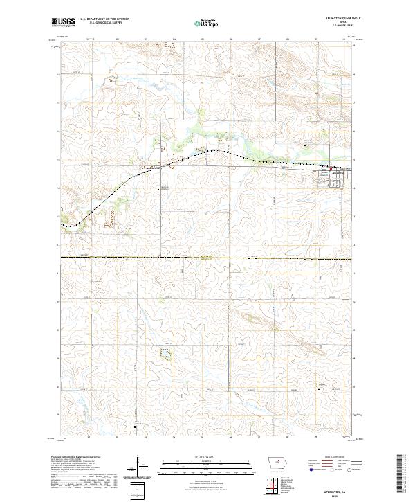
2022 Map of Aplington
USGS Topo · Published 2022About this map
Aplington and the smaller settlement of Austinville anchor this corner of Iowa, where the landscape is defined by the intricate drainage networks of Beaver Creek and its many branches. The map highlights a rural topography structured by the Butler Co and Grundy Co line, with farm-to-market roads like Co Rd T25 and Co Rd T16 cutting through the sectioned fields. For those tracing family histories in this agricultural corridor, several local burial grounds are clearly marked, including Memorial Park Cem near Austinville and both Pleasant View Cem and Pleasant Valley Cem further east and south. The terrain is notably etched by numerous waterways such as Gran Cr and N Fork S Beaver Cr, which dictate the placement of local infrastructure and historical property boundaries.
Find a feature on this map
60 named features on this map. Tap any name to fly to it.
Don’t see what you’re looking for? This feature index may not catch every label — zoom into the map to look around manually.
Map Details
Editions of this 2022 Aplington Map
This is the sole edition of this map. No revisions or reprints were ever made.
Other maps of this area

1954 · Waterloo
USGS Topo · 1:250,000

1955 · Waterloo
USGS Topo · 1:250,000

1979 · Holland
USGS Topo · 1:24,000

1979 · Ackley NE
USGS Topo · 1:24,000

1979 · Ackley
USGS Topo · 1:24,000

1979 · Steamboat Rock
USGS Topo · 1:24,000

1979 · Dumont South
USGS Topo · 1:24,000

1979 · Butler Center
USGS Topo · 1:24,000

1980 · Aplington
USGS Topo · 1:24,000

1980 · Wellsburg
USGS Topo · 1:24,000