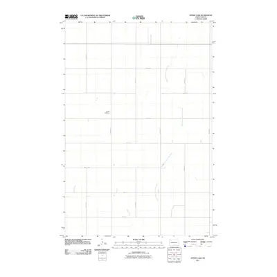
2011 Map of Appert Lake
USGS Topo · Published 2011About this map
West Branch Long Lake Creek and Spring Creek define the drainage of this agrarian landscape in Emmons County. The terrain is organized by a rigid section-line grid of rural roads, including 9th Ave SE and 70th St SE, which facilitate access to the surrounding farmsteads. The most significant man-made landmark is the Appert Lake Dam, a water management feature that reflects the region's reliance on controlled irrigation and drainage in the northern plains. This early 21st-century survey documents the persistent rural character of the area, where the vast majority of the land remains dedicated to agriculture and natural watercourses.
Find a feature on this map
17 named features on this map. Tap any name to fly to it.
Don’t see what you’re looking for? This feature index may not catch every label — zoom into the map to look around manually.
Map Details
Editions of this 2011 Appert Lake Map
This is the sole edition of this map. No revisions or reprints were ever made.
Other maps of this area

1954 · Bismarck
USGS Topo · 1:250,000

1958 · Bismarck
USGS Topo · 1:250,000

1971 · Hazelton
USGS Topo · 1:24,000

1971 · Moffit SE
USGS Topo · 1:24,000

1971 · Temvik
USGS Topo · 1:24,000

1975 · Dana
USGS Topo · 1:24,000

1975 · Appert Lake
USGS Topo · 1:24,000

1975 · Linton NE
USGS Topo · 1:24,000

1975 · Braddock
USGS Topo · 1:24,000

1979 · Bismarck
USGS Topo · 1:100,000