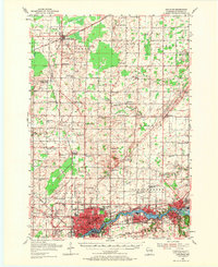
1955 Map of Appleton
USGS Topo · Published 1971About this map
The Fox River corridor serves as the industrial and social spine of this mid-1950s landscape, connecting the growing urban centers of Appleton, Kimberly, Little Chute, and Kaukauna. This belt of riverside development contrasts sharply with the expansive agricultural townships of Osborn, Freedom, and Black Creek to the north. The rural character is defined by a dense network of country schools like North Osborn Sch and Industrial Hollow Sch, many of which were still active during this survey.
Find a feature on this map
89 named features on this map. Tap any name to fly to it.
Don’t see what you’re looking for? This feature index may not catch every label — zoom into the map to look around manually.
Map Details
Editions of this 1955 Appleton Map
2 editions found
Other maps of this area

1911 · Neenah
USGS Topo · 1:62,500

1954 · De Pere
USGS Topo · 1:62,500

1954 · Chilton
USGS Topo · 1:62,500

1954 · Green Bay
USGS Topo · 1:62,500

1955 · Neenah
USGS Topo · 1:62,500

1955 · Embarrass
USGS Topo · 1:48,000

1955 · Appleton
USGS Topo · 1:24,000

1955 · Appleton
USGS Topo · 1:62,500

1955 · Neenah
USGS Topo · 1:24,000

1955 · Seymour
USGS Topo · 1:62,500