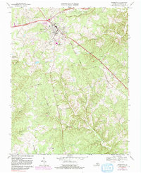
1968 Map of Appomattox
USGS Topo · Published 1991About this map
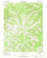
Appomattox Court House National Historical Park preserves the landscape of the famous surrender northeast of the town center, while the mid-20th-century community of Appomattox expands along the Norfolk and Western railroad corridor. The area's social fabric is visible through several country churches, such as Galilee Ch and St Anne Ch, and local gathering spots like the Drive-in Theater and Falling River Country Club. The topography is defined by the headwaters of the Appomattox River, which flows through a landscape carved by Caldwells Creek and the South Fork. Educational infrastructure is centered at the Appomattox County High School and Middle Sch, reflecting the township's growth and development during this period of aerial photographic revision.
Find a feature on this map
37 named features on this map. Tap any name to fly to it.
Don’t see what you’re looking for? This feature index may not catch every label — zoom into the map to look around manually.
Map Details
Editions of this 1968 Appomattox Map
Other maps of this area

1892 · Appomattox
USGS Topo · 1:125,000

1947 · Roanoke
USGS Topo · 1:250,000

1956 · Brookneal
USGS Topo · 1:62,500

1956 · Charlotte Court House
USGS Topo · 1:62,500

1958 · Appomattox
USGS Topo · 1:62,500

1958 · Pamplin City
USGS Topo · 1:62,500

1959 · Roanoke
USGS Topo · 1:250,000

1963 · Roanoke
USGS Topo · 1:250,000
1966 · Mike
USGS Topo · 1:24,000
1968 · Red House
USGS Topo · 1:24,000