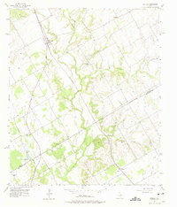
1957 Map of Aquilla
USGS Topo · Published 1975About this map
Aquilla sits as a central node in this mid-century landscape where agricultural commerce and small-town life define the terrain. The presence of the County Line Gin and the Scotts Chapel Com suggests a rural economy tied closely to the land, while the Missouri Kansas Texas railroad provides the vital link for goods moving through the region. This survey captures a specific social geography, marking several local gathering points such as Tokio Ch, Holiness Ch, and the rural community of Menlow.
Find a feature on this map
24 named features on this map. Tap any name to fly to it.
Don’t see what you’re looking for? This feature index may not catch every label — zoom into the map to look around manually.
Map Details
Editions of this 1957 Aquilla Map
3 editions found
Other maps of this area

1892 · Waco
USGS Topo · 1:125,000

1920 · Waco
USGS Topo · 1:125,000

1931 · Whitney
USGS Topo · 1:62,500

1931 · Valley Mills
USGS Topo · 1:62,500

1931 · Elm Mott
USGS Topo · 1:62,500

1954 · Waco
USGS Topo · 1:250,000

1955 · Waco
USGS Topo · 1:250,000

1956 · Abbott
USGS Topo · 1:24,000

1956 · West
USGS Topo · 1:24,000
1957 · Aquilla
USGS Topo · 1:24,000