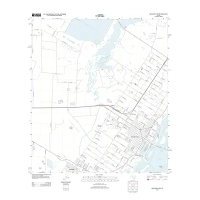
2013 Map of Aransas Pass
USGS Topo · Published 2013About this map
The coastal gateway of Aransas Pass and the industrial corridors of Ingleside define the landscape of the Texas Coastal Bend in this early 21st-century survey. The map details a complex interface between land and water, stretching from the protected waters of Conn Brown Harbor to the shallow expanse of Redfish Bay. Inland, the terrain is shaped by the drainage of McCampbell Slough and Fresh Water Lake, with aviation infrastructure provided by the T P Mc Campbell Airport. Smaller neighborhood clusters such as Millsville, Live Oak Ridge, and Falman are shown at the height of their modern development, while the Prairie View Cem stands as a permanent fixture for genealogical research. The nautical character of the region is evident in landmarks like the San Patricio County Navigation District Marina and the submerged Stedman Reef, essential for understanding local maritime history.
Find a feature on this map
147 named features on this map. Tap any name to fly to it.
Don’t see what you’re looking for? This feature index may not catch every label — zoom into the map to look around manually.
Map Details
Editions of this 2013 Aransas Pass Map
This is the sole edition of this map. No revisions or reprints were ever made.
Other maps of this area

1925 · Aransas Pass
USGS Topo · 1:62,500

1925 · Corpus Christi
USGS Topo · 1:62,500

1950 · Corpus Christi
USGS Topo · 1:250,000

1951 · Portland
USGS Topo · 1:24,000

1951 · Corpus Christi
USGS Topo · 1:62,500

1953 · Beeville
USGS Topo · 1:250,000

1954 · Rockport
USGS Topo · 1:62,500

1954 · Aransas Pass
USGS Topo · 1:24,000

1954 · Port Ingleside
USGS Topo · 1:24,000

1954 · Woodsboro
USGS Topo · 1:62,500
Featured Places
- Corpus Christi, TX
- Ingleside, TX
- Aransas Pass, TX
- Country Estates Colonia, Aransas Pass
- Mooney Lane Colonia, Ingleside