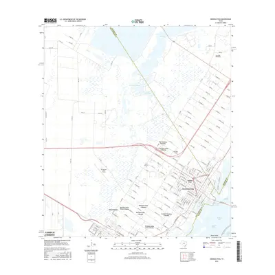
2016 Map of Aransas Pass
USGS Topo · Published 2016About this map
Aransas Pass and the northern edge of Ingleside anchor this coastal survey, where the Texas shoreline transitions from the residential grids of Live Oak Ridge into the wetlands of Live Oak Peninsula. The map reveals a complex landscape of unincorporated colonias, including The Falman Colonia, Country Acres Colonia, and the twin developments of Kenney Lane West Colonia and Kenney Lane East Colonia. These settlements are situated between the aviation activity at McCampbell-Porter Airport and the expansive waters of Port Bay.
Find a feature on this map
139 named features on this map. Tap any name to fly to it.
Don’t see what you’re looking for? This feature index may not catch every label — zoom into the map to look around manually.
Map Details
Editions of this 2016 Aransas Pass Map
This is the sole edition of this map. No revisions or reprints were ever made.
Other maps of this area

1925 · Aransas Pass
USGS Topo · 1:62,500

1925 · Corpus Christi
USGS Topo · 1:62,500

1950 · Corpus Christi
USGS Topo · 1:250,000

1951 · Portland
USGS Topo · 1:24,000

1951 · Corpus Christi
USGS Topo · 1:62,500

1953 · Beeville
USGS Topo · 1:250,000

1954 · Rockport
USGS Topo · 1:62,500

1954 · Aransas Pass
USGS Topo · 1:24,000

1954 · Port Ingleside
USGS Topo · 1:24,000

1954 · Woodsboro
USGS Topo · 1:62,500
Featured Places
- Corpus Christi, TX
- Ingleside, TX
- Aransas Pass, TX
- Country Estates Colonia, Aransas Pass
- Mooney Lane Colonia, Ingleside