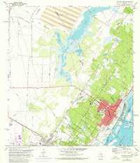
1971 Map of Aransas Pass
USGS Topo · Published 1977About this map
Redfish Bay and the intricate coastal interface of the Live Oak Peninsula anchor this mid-1970s study of the Texas Gulf Coast. The town of Aransas Pass is shown at a point of significant transition, with urban expansion noted in the street grids of Wheeler Ave and Goodnight Ave. Industrial and maritime activity is evident at the Turning Basin and Conn Brown Harbor, while the Southern Pacific railroad links these coastal hubs to the interior.
Find a feature on this map
68 named features on this map. Tap any name to fly to it.
Don’t see what you’re looking for? This feature index may not catch every label — zoom into the map to look around manually.
Map Details
Editions of this 1971 Aransas Pass Map
This is the sole edition of this map. No revisions or reprints were ever made.
Other maps of this area

1925 · Aransas Pass
USGS Topo · 1:62,500

1925 · Corpus Christi
USGS Topo · 1:62,500

1950 · Corpus Christi
USGS Topo · 1:250,000

1951 · Portland
USGS Topo · 1:24,000

1951 · Corpus Christi
USGS Topo · 1:62,500

1953 · Beeville
USGS Topo · 1:250,000

1954 · Rockport
USGS Topo · 1:62,500

1954 · Aransas Pass
USGS Topo · 1:24,000

1954 · Port Ingleside
USGS Topo · 1:24,000

1954 · Woodsboro
USGS Topo · 1:62,500