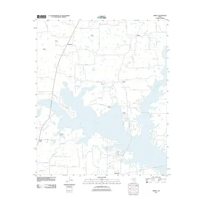
2011 Map of Arbala
USGS Topo · Published 2011About this map
The sprawling waters of Lake Fork Reservoir dominate the landscape of Hopkins and Rains counties, creating a complex system of inlets and fingers that define the local geography. Small rural settlements like Arbala, Bonanza, and Poole are connected by a network of county roads and farm-to-market routes, including FM 1567 and FM 514. This terrain is deeply marked by its family and community history, evidenced by numerous burial grounds such as the Ishmeal Cemetery, Welch Cemetery, and the uniquely named Robertson-Henrys Chapel Cemetery. The map captures a landscape where the natural hydrology of White Oak Branch and Penson Spring Branch has been transformed by modern reservoir development, yet the original rural framework of small holdings and local landmarks remains clearly visible.
Find a feature on this map
74 named features on this map. Tap any name to fly to it.
Don’t see what you’re looking for? This feature index may not catch every label — zoom into the map to look around manually.
Map Details
Editions of this 2011 Arbala Map
This is the sole edition of this map. No revisions or reprints were ever made.
Other maps of this area

1953 · Texarkana
USGS Topo · 1:250,000

1956 · Texarkana
USGS Topo · 1:250,000

1956 · Tyler
USGS Topo · 1:250,000

1956 · Emory
USGS Topo · 1:62,500

1958 · Arbala
USGS Topo · 1:24,000

1958 · Alba
USGS Topo · 1:24,000

1959 · Calvary
USGS Topo · 1:24,000

1959 · Yantis
USGS Topo · 1:24,000

1959 · Alba
USGS Topo · 1:62,500

1962 · Miller Grove
USGS Topo · 1:24,000