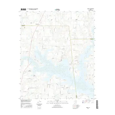
2016 Map of Arbala
USGS Topo · Published 2016About this map
Arbala and Bonanza sit at the intersection of Hopkins, Rains, and Wood Counties, where the East Texas landscape is defined by the branching waterways of Case Lake. This 2016 survey documents a rural environment heavily marked by family history, with numerous small burial grounds such as Welch Cem, Ishmeal Cem, and Elm Cem scattered across the countryside. The geography is dominated by a complex network of creeks including Gordon Br and White Oak Br, which feed into the larger reservoirs. The presence of John R. Armstrong Memorial Field and the Robertson-Henrys Chapel Cem suggests a community where modern recreational spaces coexist with historic local foundations. This map provides a clear view of the rural road network, from state routes like FM 1567 to numerous county roads that connect these small settlements and historic landmarks.
Find a feature on this map
113 named features on this map. Tap any name to fly to it.
Don’t see what you’re looking for? This feature index may not catch every label — zoom into the map to look around manually.
Map Details
Editions of this 2016 Arbala Map
This is the sole edition of this map. No revisions or reprints were ever made.
Other maps of this area

1953 · Texarkana
USGS Topo · 1:250,000

1956 · Texarkana
USGS Topo · 1:250,000

1956 · Tyler
USGS Topo · 1:250,000

1956 · Emory
USGS Topo · 1:62,500

1958 · Arbala
USGS Topo · 1:24,000

1958 · Alba
USGS Topo · 1:24,000

1959 · Calvary
USGS Topo · 1:24,000

1959 · Yantis
USGS Topo · 1:24,000

1959 · Alba
USGS Topo · 1:62,500

1962 · Miller Grove
USGS Topo · 1:24,000