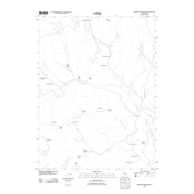
2012 Map of Arbuckle Mountain
USGS Topo · Published 2012About this map
Arbuckle Mountain and the surrounding drainage of the Middle Fork Cottonwood Cr define this pocket of Shasta County. The map documents a landscape characterized by complex water systems and high-country ranching, with the AC Graves Ranch and Seivester Ranch positioned near the convergence of gulches and creeks. Names like Bullion Gulch, Cut-Throat Gulch, and Tincup Gulch hint at the region’s early prospecting history and the small-scale mineral exploration that once defined these remote ridges. The network of local routes, including Platina Rd and Duncan Circle Rd, provide access to landmarks such as Old Man Rock and the high vantage of Two Rock Ridge. This 2012 survey illustrates how the rugged topography of the Arbuckle Basin continues to shape the footprint of human activity in the Northern California interior.
Find a feature on this map
39 named features on this map. Tap any name to fly to it.
Don’t see what you’re looking for? This feature index may not catch every label — zoom into the map to look around manually.
Map Details
Editions of this 2012 Arbuckle Mountain Map
This is the sole edition of this map. No revisions or reprints were ever made.
Other maps of this area

1890 · Red Bluff
USGS Topo · 1:250,000

1894 · Red Bluff
USGS Topo · 1:250,000

1913 · Weaverville
USGS Topo · 1:125,000

1944 · French Gulch
USGS Topo · 1:62,500

1948 · French Gulch
USGS Topo · 1:62,500

1950 · Weaverville
USGS Topo · 1:62,500

1951 · Chanchelulla Peak
USGS Topo · 1:62,500

1952 · Weaverville
USGS Topo · 1:62,500

1952 · Ono
USGS Topo · 1:62,500

1958 · Redding
USGS Topo · 1:250,000