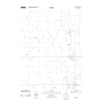
2013 Map of Arcadia
USGS Topo · Published 2013About this map
Morse Reservoir serves as a major geographical anchor at the southern edge of this Central Indiana landscape, where the waters of Cicero Cr and Bear Slide Cr converge. The area is defined by a string of historic railroad-aligned settlements, including Atlanta, Millersburg, and Arcadia, which maintain their traditional grid layouts amidst a surrounding patchwork of agricultural land. The transition from small-town streetscapes to rural tracts is marked by local landmarks like Skyridge Airport and the Bee-Acre Farm Strip Airport, reflecting the region's aviation and farming heritage. Numerous small waterways, such as Little Cicero Cr, Taylor Cr, and the descriptively named Possum Run, weave through the township sections, tracing the drainage patterns that have shaped Hamilton County's development from early farming through modern water management.
Find a feature on this map
122 named features on this map. Tap any name to fly to it.
Don’t see what you’re looking for? This feature index may not catch every label — zoom into the map to look around manually.
Map Details
Editions of this 2013 Arcadia Map
This is the sole edition of this map. No revisions or reprints were ever made.
Other maps of this area

1953 · Westfield
USGS Topo · 1:24,000

1953 · Riverwood
USGS Topo · 1:24,000

1953 · Noblesville
USGS Topo · 1:24,000

1953 · Danville
USGS Topo · 1:250,000

1953 · Muncie
USGS Topo · 1:250,000

1955 · Danville
USGS Topo · 1:250,000

1956 · Muncie
USGS Topo · 1:250,000

1956 · Danville
USGS Topo · 1:250,000

1960 · Noblesville
USGS Topo · 1:24,000

1960 · Kempton
USGS Topo · 1:24,000