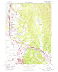
1959 Map of Arcata North
USGS Topo · Published 1988About this map
McKinleyville and the surrounding coastal terrace of northern Humboldt County show significant mid-century development on this map, which combines original 1959 surveying with early 1970s revisions. The landscape is defined by the broad Arcata Bottoms and the winding course of the Mad River, where transportation networks like the Redwood Highway and the Northwestern Pacific railroad connect industrial hubs such as the local lumber mill. Educational and civic life is anchored by a high concentration of rural school sites, including Morris Sch, Warren Creek Sch, and Janes School. In the north, the Arcata Airport and its nearby Radio Transmitter mark the modernization of the coastal strip, while the interior is characterized by rugged drainage basins like Lindsay Creek and ridges such as Fickle Hill, reflecting the region's historic reliance on both aviation and timber resources.
Find a feature on this map
62 named features on this map. Tap any name to fly to it.
Don’t see what you’re looking for? This feature index may not catch every label — zoom into the map to look around manually.
Map Details
Editions of this 1959 Arcata North Map
4 editions found
Other maps of this area

1922 · Eureka
USGS Topo · 1:62,500

1922 · Korbel
USGS Topo · 1:62,500

1925 · Hoopa
USGS Topo · 1:125,000

1933 · Eureka
USGS Topo · 1:48,000

1942 · Eureka
USGS Topo · 1:62,500

1945 · Trinidad
USGS Topo · 1:62,500

1945 · Coyote Peak
USGS Topo · 1:62,500

1945 · Blue Lake
USGS Topo · 1:62,500

1948 · Weed
USGS Topo · 1:250,000

1949 · Eureka
USGS Topo · 1:250,000