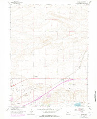
1963 Map of Archer
USGS Topo · Published 1978About this map
The settlement of Archer and the agricultural lands of the Wyoming Hereford Ranch anchor this landscape just east of Cheyenne during the early 1960s. The region is defined by a network of water management features, including the Bolln Ditch and Stewart Ditch which draw from Crow Creek. The industrial and transportation corridor of the Union Pacific Railroad cuts through the territory, running parallel to an Old Grade and modern thoroughfares like Dell Blvd and Pershing Blvd. Educational and civic development is evident at the Dildine Sch and the Univ of Wyoming Experimental Station. Notable land use includes the Cheyenne Memorial Gardens and several Gravel Pits, reflecting the area's growth and infrastructure needs. Purple overprints added in the late 1970s illustrate the expansion of urban areas and new pipeline routes, marking the transition from a purely rural ranching environment to a more developed suburban fringe.
Find a feature on this map
25 named features on this map. Tap any name to fly to it.
Don’t see what you’re looking for? This feature index may not catch every label — zoom into the map to look around manually.
Map Details
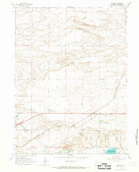
Editions of this 1963 Archer Map
2 editions found
Other maps of this area

1911 · Cheyenne
USGS Topo · 1:125,000

1914 · Cheyenne
USGS Topo · 1:125,000

1950 · Cheyenne
USGS Topo · 1:62,500

1954 · Cheyenne
USGS Topo · 1:250,000

1958 · Cheyenne
USGS Topo · 1:250,000

1961 · Cheyenne South
USGS Topo · 1:24,000

1961 · Cheyenne
USGS Topo · 1:62,500

1961 · Cheyenne North
USGS Topo · 1:24,000

1962 · P O Ranch
USGS Topo · 1:24,000

1963 · Pole Creek Ranch SE
USGS Topo · 1:24,000