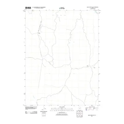
2011 Map of Archy Bench SE
USGS Topo · Published 2011About this map
The Rock House Gas Field anchors the northern high desert landscape of Uintah County in this early 21st-century study. The area is defined by a sparse but functional network of range infrastructure and energy extraction, where names like Olsen Corral and Cedar Corral indicate the enduring presence of livestock ranching alongside the natural gas industry. Local history is etched into the terrain at sites like Seely Cabin, located on the eastern edge of the map. Navigation through this arid environment follows the natural drainage patterns of Asphalt Wash and Bitter Creek, with travel limited to rugged corridors such as Bitter Creek Rd and Kings Wells Rd. The naming of the West Fork Asphalt Wash and West Fork Saddletree Draw highlights the complex system of dry washes and draws that dictate the movement of water and people across this remote basin.
Find a feature on this map
11 named features on this map. Tap any name to fly to it.
Don’t see what you’re looking for? This feature index may not catch every label — zoom into the map to look around manually.
Map Details
Editions of this 2011 Archy Bench SE Map
This is the sole edition of this map. No revisions or reprints were ever made.
Other maps of this area

1885 · East Tavaputs
USGS Topo · 1:250,000

1956 · Grand Junction
USGS Topo · 1:250,000

1959 · Grand Junction
USGS Topo · 1:250,000

1960 · Grand Junction
USGS Topo · 1:250,000

1962 · Grand Junction
USGS Topo · 1:250,000

1964 · Grand Junction
USGS Topo · 1:250,000

1965 · Grand Junction
USGS Topo · 1:250,000

1966 · Bates Knolls
USGS Topo · 1:24,000
1966 · Copper Canyon
USGS Topo · 1:24,000
1966 · Burnt Timber Canyon
USGS Topo · 1:24,000