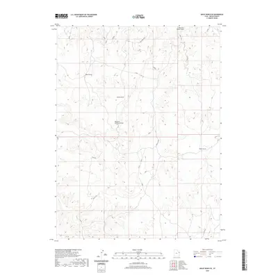
2020 Map of Archy Bench SE
USGS Topo · Published 2020About this map
Olsen Corral and Cedar Corral anchor this remote landscape in the Uintah Basin, reflecting the livestock and ranching history of eastern Utah. The terrain is defined by a series of drainage systems, including Atchees Wash, West Fork Saddletree Draw, and the West Fork Asphalt Wash. These intermittent waterways carve through the high plateau, creating prominent features such as Liams Pass and the uniquely named Ho Chi Rim. The presence of Oil Springs Rd and various numbered access routes hints at the region's intersection of traditional grazing lands and modern energy exploration. Small portions of Bitter Cr appear in the southwest, while the Rock House Loop suggests established routes through this high-altitude environment during the early 21st century.
Find a feature on this map
28 named features on this map. Tap any name to fly to it.
Don’t see what you’re looking for? This feature index may not catch every label — zoom into the map to look around manually.
Map Details
Editions of this 2020 Archy Bench SE Map
This is the sole edition of this map. No revisions or reprints were ever made.
Other maps of this area

1885 · East Tavaputs
USGS Topo · 1:250,000

1956 · Grand Junction
USGS Topo · 1:250,000

1959 · Grand Junction
USGS Topo · 1:250,000

1960 · Grand Junction
USGS Topo · 1:250,000

1962 · Grand Junction
USGS Topo · 1:250,000

1964 · Grand Junction
USGS Topo · 1:250,000

1965 · Grand Junction
USGS Topo · 1:250,000

1966 · Bates Knolls
USGS Topo · 1:24,000
1966 · Copper Canyon
USGS Topo · 1:24,000
1966 · Burnt Timber Canyon
USGS Topo · 1:24,000