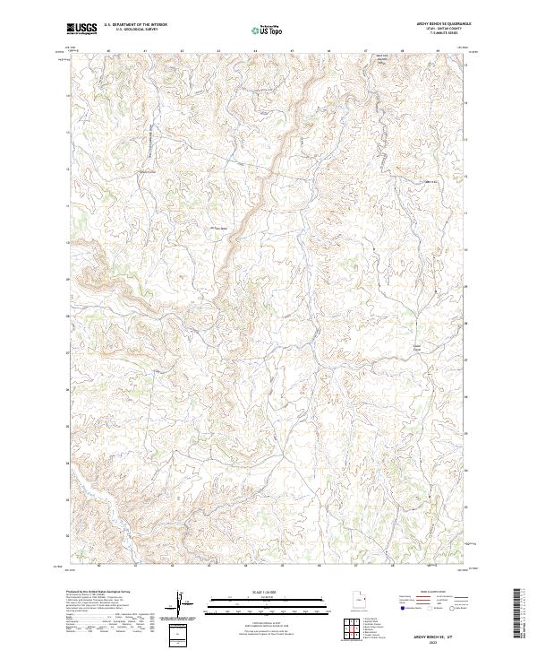
2023 Map of Archy Bench SE
USGS Topo · Published 2023About this map
Olsen Corral and the surrounding high desert terrain define this corner of Uintah County, where the drainage network creates a complex system of washes and draws. Water, though intermittent, has shaped the landscape and its historical use, as seen in the paths of West Fork Asphalt Wash, Atchees Wash, and the southern flow of Bitter Creek. The naming of features like Ho Chi Rim and Liams Pass suggests a more modern layer of local nomenclature layered over the traditional cattle-ranching infrastructure of the basin.
Find a feature on this map
9 named features on this map. Tap any name to fly to it.
Don’t see what you’re looking for? This feature index may not catch every label — zoom into the map to look around manually.
Map Details
Editions of this 2023 Archy Bench SE Map
This is the sole edition of this map. No revisions or reprints were ever made.
Other maps of this area

1885 · East Tavaputs
USGS Topo · 1:250,000

1956 · Grand Junction
USGS Topo · 1:250,000

1959 · Grand Junction
USGS Topo · 1:250,000

1960 · Grand Junction
USGS Topo · 1:250,000

1962 · Grand Junction
USGS Topo · 1:250,000

1964 · Grand Junction
USGS Topo · 1:250,000

1965 · Grand Junction
USGS Topo · 1:250,000

1966 · Bates Knolls
USGS Topo · 1:24,000
1966 · Copper Canyon
USGS Topo · 1:24,000
1966 · Burnt Timber Canyon
USGS Topo · 1:24,000