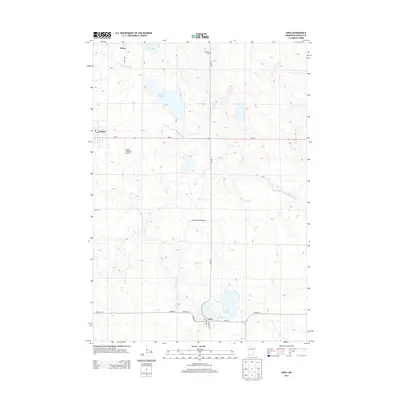
2013 Map of Arco
USGS Topo · Published 2013About this map
The Coteau des Prairies highland plateau defines the landscape of this Lincoln County region, where glacial landforms create a complex network of small lakes and drainage patterns. The community of Arco sits along the southern shore of Lake Stay, serving as a focal point for the surrounding agricultural prairie. To the northwest, the town of Ivanhoe and the settlement of Wilno anchor the local road network, which follows a rigid section-line grid typical of the American Midwest.
Find a feature on this map
22 named features on this map. Tap any name to fly to it.
Don’t see what you’re looking for? This feature index may not catch every label — zoom into the map to look around manually.
Map Details
Editions of this 2013 Arco Map
This is the sole edition of this map. No revisions or reprints were ever made.
Other maps of this area

1953 · Watertown
USGS Topo · 1:250,000

1958 · Watertown
USGS Topo · 1:250,000

1963 · Dead Coon Lake
USGS Topo · 1:24,000

1963 · Gislason Lake
USGS Topo · 1:24,000

1963 · Tyler
USGS Topo · 1:24,000

1963 · Arco
USGS Topo · 1:24,000
1967 · Porter SW
USGS Topo · 1:24,000

1967 · Lake Benton
USGS Topo · 1:24,000
1967 · Taunton
USGS Topo · 1:24,000

1967 · Canby SE
USGS Topo · 1:24,000