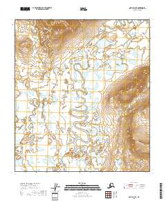
2018 Map of Arctic B-3 SE
USGS Topo · Published 2018About this map
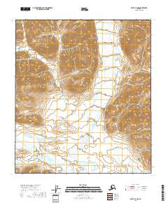
The East Fork Chandalar River meanders through this portion of the Yukon-Koyukuk Census Area, defining a landscape dominated by extensive wetlands and glacial lakes. This 2018 survey reveals a complex hydrological network where the main river course is joined by the Junjik River in the southwest. The terrain is characterized by numerous named water bodies, including the descriptively titled Below Tree Lake and the smaller Tinjik Lake. In the southern reaches, Grass Lake and the succinctly named G Lake sit within a low-lying basin. The map illustrates a remote Alaskan wilderness, highlighting the natural drainage patterns and the specific township and range boundaries that organize this undeveloped territory, such as t13s r29e and t14s r30e.
Find a feature on this map
12 named features on this map. Tap any name to fly to it.
Don’t see what you’re looking for? This feature index may not catch every label — zoom into the map to look around manually.
Map Details
Editions of this 2018 Arctic B-3 SE Map
This is the sole edition of this map. No revisions or reprints were ever made.
Other maps of this area

1951 · Arctic
USGS Topo · 1:250,000

1956 · Arctic
USGS Topo · 1:250,000

1972 · Arctic A-3
USGS Topo · 1:63,360

1972 · Arctic A-2
USGS Topo · 1:63,360

1983 · Arctic B-2
USGS Topo · 1:63,360

1983 · Arctic B-3
USGS Topo · 1:63,360
2018 · Arctic A-2 NW
USGS Topo · 1:25,000
2018 · Arctic B-2 NW
USGS Topo · 1:25,000
2018 · Arctic B-2 SW
USGS Topo · 1:25,000
2018 · Arctic B-3 NW
USGS Topo · 1:25,000