
1983 Map of Arctic C-2
USGS Topo · Published 1984About this map
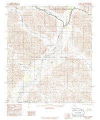
The East Fork Chandalar River winds through the heart of this North Slope landscape, a region defined by its protected status and lack of human infrastructure. This survey captures the terrain shortly after the federal reservation boundaries were established by the Alaska National Interest Lands Conservation Act of 1980. The map encompasses portions of the Arctic National Wildlife Refuge and the Arctic Wildlife Refuge Wilderness, areas where the topographical detail focuses entirely on natural drainages and mountain peaks. Braided stream beds characterize the river valley, while several significant tributaries such as Red Sheep Creek, Cane Creek, and Old Woman Creek cut through the surrounding elevations. With no roads or trails noted in the area, the map serves as a primary reference for the naming of distinct geographic features like Flatrock Creek during this era of conservation.
Find a feature on this map
7 named features on this map. Tap any name to fly to it.
Don’t see what you’re looking for? This feature index may not catch every label — zoom into the map to look around manually.
Map Details
Editions of this 1983 Arctic C-2 Map
2 editions found
Other maps of this area

1951 · Arctic
USGS Topo · 1:250,000

1956 · Arctic
USGS Topo · 1:250,000
1983 · Arctic C-1
USGS Topo · 1:63,360

1983 · Arctic C-3
USGS Topo · 1:63,360

1983 · Arctic B-2
USGS Topo · 1:63,360
1983 · Arctic D-2
USGS Topo · 1:63,360

1983 · Arctic B-3
USGS Topo · 1:63,360
1983 · Arctic B-1
USGS Topo · 1:63,360
1983 · Arctic D-3
USGS Topo · 1:63,360
1983 · Arctic D-1
USGS Topo · 1:63,360