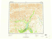
1956 Map of Arctic
USGS Topo · Published 1959About this map
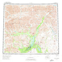
Arctic Village and the surrounding Venetie Indian Reservation anchor this mid-century survey of the northern interior. The map illustrates a high-latitude landscape defined by the drainage systems of the Canning River and the Sagavanirktok River, where early aviation and traditional routes meet at landmarks like Carter Pass. Small outposts such as John Franks Cabins and several unnamed cabins suggest the seasonal trapping and hunting patterns of the Gwich'in people and early explorers during the 1950s.
Find a feature on this map
70 named features on this map. Tap any name to fly to it.
Don’t see what you’re looking for? This feature index may not catch every label — zoom into the map to look around manually.
Map Details
Editions of this 1956 Arctic Map
8 editions found

Other maps of this area

1951 · Sagavanirktok D-5
USGS Topo · 1:250,000

1951 · Demarcation Point
USGS Topo · 1:250,000

1951 · Coleen
USGS Topo · 1:250,000

1951 · Chandalar
USGS Topo · 1:250,000

1951 · Christian
USGS Topo · 1:250,000

1951 · Brooks
USGS Topo · 1:250,000

1951 · Arctic
USGS Topo · 1:250,000

1951 · Table Mountain
USGS Topo · 1:250,000

1951 · Mt. Michelson
USGS Topo · 1:250,000

1955 · Demarcation Point
USGS Topo · 1:250,000