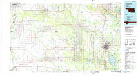
1986 Map of Ardmore
USGS Topo · Published 1986About this map
The Arbuckle Mountains dominate the northeastern reaches of this 1980s landscape, providing a geological backdrop to a region defined by extensive petroleum extraction and recreational development. Extensive energy infrastructure is evident through the Palacine Oil Field, Sholem Alechem Oil Field, and Tatums Oil Field, while settlements like Oil City and Asphaltum further reflect the industrial heritage of southern Oklahoma.
Find a feature on this map
131 named features on this map. Tap any name to fly to it.
Don’t see what you’re looking for? This feature index may not catch every label — zoom into the map to look around manually.
Map Details
Editions of this 1986 Ardmore Map
2 editions found

Other maps of this area

1898 · Pauls Valley
USGS Topo · 1:125,000

1901 · Stonewall
USGS Topo · 1:125,000

1901 · Addington
USGS Topo · 1:125,000

1901 · Tishomingo
USGS Topo · 1:125,000

1901 · Ardmore
USGS Topo · 1:125,000

1901 · Denison
USGS Topo · 1:125,000

1902 · Gainesville
USGS Topo · 1:125,000

1902 · Pauls Valley
USGS Topo · 1:125,000

1902 · Rush Springs
USGS Topo · 1:125,000

1905 · Montague
USGS Topo · 1:125,000