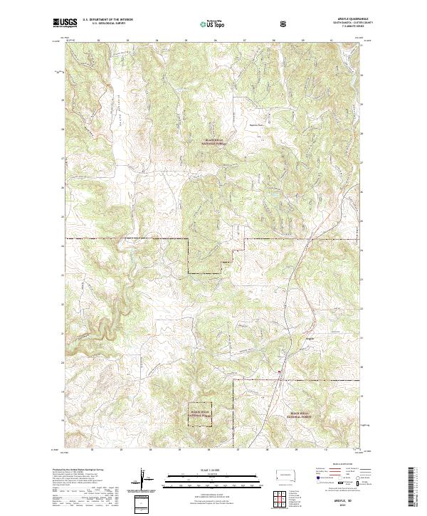
2021 Map of Argyle
USGS Topo · Published 2021About this map
Black Hills National Forest land defines this landscape near the settlement of Argyle, where the transition from high plateaus to deep drainage systems is meticulously recorded. The terrain is marked by distinctive geographical features such as Hopkins Flats in the north and the deep incisions of Red Canyon and Cold Brook Canyon to the south and east. A complex network of ranch roads and forest routes, including Stage Stop Rd, Canyon Rim Ranch Rd, and Pleasant Valley Rd, provides access across the rugged topography. Vital water sources like Dallan Spring and Upper Hand Spring are located near the headwaters of Pleasant Valley Cr. This area reflects the modern land management patterns of southwestern South Dakota, where private ranching interests and public forest lands meet among the limestone outcrops and pine-covered ridges.
Find a feature on this map
70 named features on this map. Tap any name to fly to it.
Don’t see what you’re looking for? This feature index may not catch every label — zoom into the map to look around manually.
Map Details
Editions of this 2021 Argyle Map
This is the sole edition of this map. No revisions or reprints were ever made.
Other maps of this area

1896 · Harney Peak
USGS Topo · 1:125,000

1901 · Harney Peak
USGS Topo · 1:125,000

1902 · Edgemont
USGS Topo · 1:125,000

1950 · Edgemont NE
USGS Topo · 1:24,000

1950 · Minnekahta
USGS Topo · 1:24,000

1951 · Minnekahta NE
USGS Topo · 1:24,000

1954 · Fourmile
USGS Topo · 1:24,000

1954 · Jewel Cave SE
USGS Topo · 1:24,000

1955 · Jewel Cave
USGS Topo · 1:24,000
1955 · Argyle
USGS Topo · 1:24,000