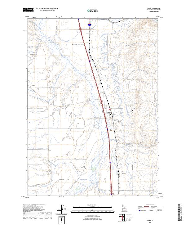
2023 Map of Arimo
USGS Topo · Published 2023About this map
Marsh Valley serves as a central corridor for transport and irrigation in this part of Bannock County, flanked by the rising Portneuf Range to the east. The settlement of Arimo sits along the primary north-south transit route, supported by a network of local irrigation works including the Portneuf Marsh Valley Canal and the Arino Ditch. These waterways manage the flow from numerous tributaries like Marsh Creek, Arkansas Creek, and Beck Creek as they traverse the valley floor. West of the main valley, the community of Robin is situated near the headwaters of Garden Creek. Local genealogy and land use history are anchored by landmarks such as the Arimo Cem and Marsh Center Cem, alongside the extensive Meadowbrook Ranch located along the banks of Hawkins Creek.
Find a feature on this map
58 named features on this map. Tap any name to fly to it.
Don’t see what you’re looking for? This feature index may not catch every label — zoom into the map to look around manually.
Map Details
Editions of this 2023 Arimo Map
This is the sole edition of this map. No revisions or reprints were ever made.
Other maps of this area

1954 · Pocatello
USGS Topo · 1:250,000

1958 · Pocatello
USGS Topo · 1:250,000

1968 · Downey West
USGS Topo · 1:24,000

1968 · Wakley Peak
USGS Topo · 1:24,000
1968 · Downey East
USGS Topo · 1:24,000

1968 · Hawkins
USGS Topo · 1:24,000

1968 · Lava Hot Springs
USGS Topo · 1:24,000
1968 · Arimo
USGS Topo · 1:24,000
1968 · Haystack Mtn
USGS Topo · 1:24,000

1968 · Mc Cammon
USGS Topo · 1:24,000