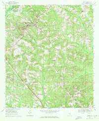
1969 Map of Ariton
USGS Topo · Published 1971About this map
Ariton serves as the rail hub for this section of the Wiregrass region, where the Seaboard Coast Line and Central of Georgia railroads intersect. The landscape is defined by the dendritic drainage patterns of Claybank Creek and Bear Creek, which flow southward toward the Pea River at the northwestern corner of the quadrangle. This 1969 field check reveals a rural society anchored by country churches and family burial grounds, many of which are preserved together like the Pleasant Grove Ch (Cem) and Bethel Ch (Cem). Notable for local historians is the Universalist Cem located west of the main settlement. Small communities such as Dillard and Dill appear as clusters of homes along the primary routes, maintaining a pattern of upland farming and timber tracts that has persisted since the late 19th century.
Find a feature on this map
40 named features on this map. Tap any name to fly to it.
Don’t see what you’re looking for? This feature index may not catch every label — zoom into the map to look around manually.
Map Details
Editions of this 1969 Ariton Map
2 editions found
Other maps of this area

1942 · Enterprise
USGS Topo · 1:125,000

1948 · Ozark
USGS Topo · 1:62,500

1948 · Brundidge
USGS Topo · 1:62,500

1950 · Ozark
USGS Topo · 1:62,500

1950 · Enterprise
USGS Topo · 1:62,500

1950 · Brundidge
USGS Topo · 1:62,500

1953 · Dothan
USGS Topo · 1:250,000

1954 · Dothan
USGS Topo · 1:250,000

1955 · Dothan
USGS Topo · 1:250,000

1960 · Ewell
USGS Topo · 1:24,000