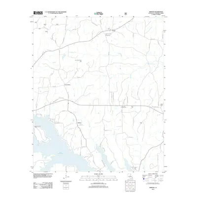
2012 Map of Arizona
USGS Topo · Published 2012About this map
Lake Claiborne dominates the southwestern portion of this Claiborne Parish survey, where numerous residential roads like Bream Island Rd and Bella Vista Rd line its shores. The landscape transitions into a mix of timberlands and energy production, defined by the McCasland Creek Oil and Gas Field and the West Lisbon Oil and Gas Field. These industrial sites sit alongside long-established rural settlements such as Antioch, Forest Grove, and the small community of Arizona. Genealogists will find a significant number of family and community burial grounds, including Antioch Cem, White Cem, and Rocky Springs Cem. The presence of the Forest Grove School and the Homer Municipal Airport reflects the area's role as a local hub, balancing the quiet character of the creek bottoms along McCasland Cr and Bear Cr with modern infrastructure and resource extraction.
Find a feature on this map
77 named features on this map. Tap any name to fly to it.
Don’t see what you’re looking for? This feature index may not catch every label — zoom into the map to look around manually.
Map Details
Editions of this 2012 Arizona Map
This is the sole edition of this map. No revisions or reprints were ever made.
Other maps of this area

1949 · Gibsland
USGS Topo · 1:62,500

1950 · Gibsland
USGS Topo · 1:62,500

1950 · Arcadia
USGS Topo · 1:62,500

1951 · Arcadia
USGS Topo · 1:62,500

1951 · Summerfield
USGS Topo · 1:62,500

1952 · Homer
USGS Topo · 1:62,500

1955 · Shreveport
USGS Topo · 1:250,000

1956 · Shreveport
USGS Topo · 1:250,000

1984 · Shreveport
USGS Topo · 1:250,000

1985 · Monroe North
USGS Topo · 1:100,000