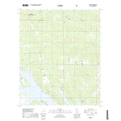
2018 Map of Arizona
USGS Topo · Published 2018About this map
Lisbon and the smaller community of Antioch anchor the northern landscape of Claiborne Parish in this modern survey. The southern half of the map is dominated by the extensive fingers of Lake Claiborne, which create a complex shoreline featuring Bream Island. The terrain is defined by numerous waterways, including McCasland Cr and Green Cr, which drain the timberlands of the Kisatchie National Forest in the northwest corner.
Find a feature on this map
70 named features on this map. Tap any name to fly to it.
Don’t see what you’re looking for? This feature index may not catch every label — zoom into the map to look around manually.
Map Details
Editions of this 2018 Arizona Map
This is the sole edition of this map. No revisions or reprints were ever made.
Other maps of this area

1949 · Gibsland
USGS Topo · 1:62,500

1950 · Gibsland
USGS Topo · 1:62,500

1950 · Arcadia
USGS Topo · 1:62,500

1951 · Arcadia
USGS Topo · 1:62,500

1951 · Summerfield
USGS Topo · 1:62,500

1952 · Homer
USGS Topo · 1:62,500

1955 · Shreveport
USGS Topo · 1:250,000

1956 · Shreveport
USGS Topo · 1:250,000

1984 · Shreveport
USGS Topo · 1:250,000

1985 · Monroe North
USGS Topo · 1:100,000