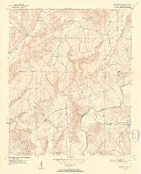
1951 Map of Arkadelphia
USGS Topo · Published 1952About this map
Arkadelphia Mountain and Prospect Mountain dominate this mid-century landscape where Cullman and Blount counties meet. The settlement of Arkadelphia sits near the junction of Sullivan Creek and Little Creek, serving as a central hub for a network of country churches including Enterprise Ch and Bethel Ch. To the east, The Colony is home to the Colony Sch and nearby Fairview Ch, illustrating the tight-knit community structures of the early 1950s.
Find a feature on this map
36 named features on this map. Tap any name to fly to it.
Don’t see what you’re looking for? This feature index may not catch every label — zoom into the map to look around manually.
Map Details
Editions of this 1951 Arkadelphia Map
5 editions found

Other maps of this area

1888 · Cullman
USGS Topo · 1:125,000

1889 · Birmingham
USGS Topo · 1:125,000

1892 · Cullman
USGS Topo · 1:125,000

1892 · Birmingham
USGS Topo · 1:125,000

1893 · Jasper
USGS Topo · 1:125,000

1895 · Birmingham
USGS Topo · 1:125,000

1907 · Birmingham
USGS Topo · 1:125,000

1949 · Sipsey
USGS Topo · 1:24,000

1949 · Cold Springs
USGS Topo · 1:24,000

1951 · Cold Springs
USGS Topo · 1:24,000