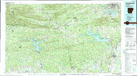
1986 Map of Arkadelphia
USGS Topo · Published 1988About this map
Arkadelphia serves as the focal point of this 1980s survey, where the campuses of Henderson State University and Ouachita Baptist University sit near the banks of the Ouachita River. The landscape transitions from the dense ridges of the Ouachita Mountains and Cossatot Mountains in the north and west toward the agricultural plains of the south. Water management and recreation are central to the region's character, evidenced by the expansive reaches of De Gray Lake and Lake Greeson. To the southwest, the unique geology of the region is highlighted by Crater of Diamonds State Park near Murfreesboro. The Missouri Pacific railroad corridor provides a clear structural axis for the eastern settlements, connecting the regional center at Arkadelphia with smaller communities like Okolona and Antoine along the many creek and river drainages.
Find a feature on this map
83 named features on this map. Tap any name to fly to it.
Don’t see what you’re looking for? This feature index may not catch every label — zoom into the map to look around manually.
Map Details
Editions of this 1986 Arkadelphia Map
2 editions found
Other maps of this area

1890 · Mount Ida
USGS Topo · 1:125,000

1890 · Benton
USGS Topo · 1:125,000

1890 · Poteau Mountain
USGS Topo · 1:125,000

1890 · Hot Springs
USGS Topo · 1:125,000

1894 · Hot Springs
USGS Topo · 1:125,000

1894 · Benton
USGS Topo · 1:125,000

1899 · Poteau Mountain
USGS Topo · 1:125,000

1901 · Gurdon
USGS Topo · 1:125,000

1903 · Camden
USGS Topo · 1:125,000

1906 · Caddo Gap
USGS Topo · 1:125,000