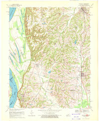
1970 Map of Arlington
USGS Topo · Published 1972About this map
The Mississippi River floodplain and its transition to the Kentucky uplands define this 1970 landscape. The riverside is a complex network of backwaters and sloughs, including Fish Lake, Crooked Lake, and Goose Pond, which gave way to early settlements like Laketon and the historic river crossing at Belmont Landing. On the high ground, Columbus-Belmont State Park preserves the strategic bluff-top territory overlooking the river. Inland, the Gulf Mobile and Ohio railroad corridor anchors the communities of Arlington and Bardwell. For genealogists, the map preserves the locations of numerous family-named landmarks and rural burial grounds, including Roselawn Cem, Dicus Cem, and Taylor Cem. The interior is marked by small rural congregations such as Beech Grove Ch and Oak Grove Ch, reflecting the dispersed agricultural and timber-based economy of the mid-20th century.
Find a feature on this map
46 named features on this map. Tap any name to fly to it.
Don’t see what you’re looking for? This feature index may not catch every label — zoom into the map to look around manually.
Map Details
Editions of this 1970 Arlington Map
Other maps of this area

1939 · Wickliffe
USGS Topo · 1:62,500

1939 · Hickman
USGS Topo · 1:62,500

1951 · Blandville
USGS Topo · 1:24,000

1951 · Oakton
USGS Topo · 1:24,000

1951 · Wolf Island
USGS Topo · 1:24,000

1951 · Wickliffe SW
USGS Topo · 1:24,000

1951 · Arlington
USGS Topo · 1:24,000

1951 · Wickliffe
USGS Topo · 1:24,000

1951 · Milburn
USGS Topo · 1:24,000

1952 · Clinton
USGS Topo · 1:24,000