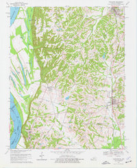
1970 Map of Arlington
USGS Topo · Published 1977About this map
The Mississippi River defines the western edge of this landscape, carving a wide floodplain marked by backwaters like Forked Lake, Crooked Lake, and Indian Camp Lake. High atop the Mississippi Bluff, Columbus-Belmont State Park overlooks the water, preserving a site of significant strategic importance. The interior terrain shifts into the dissected uplands of Carlisle and Hickman Counties, where a dense network of family-named cemeteries such as Rogers Cem, Allred Cem, and Taylor Cem are tucked between the ridges and stream valleys.
Find a feature on this map
54 named features on this map. Tap any name to fly to it.
Don’t see what you’re looking for? This feature index may not catch every label — zoom into the map to look around manually.
Map Details
Editions of this 1970 Arlington Map
Other maps of this area

1939 · Wickliffe
USGS Topo · 1:62,500

1939 · Hickman
USGS Topo · 1:62,500

1951 · Blandville
USGS Topo · 1:24,000

1951 · Oakton
USGS Topo · 1:24,000

1951 · Wolf Island
USGS Topo · 1:24,000

1951 · Wickliffe SW
USGS Topo · 1:24,000

1951 · Arlington
USGS Topo · 1:24,000

1951 · Wickliffe
USGS Topo · 1:24,000

1951 · Milburn
USGS Topo · 1:24,000

1952 · Clinton
USGS Topo · 1:24,000