2022 Map of Arlington
USGS Topo · Published 2022About this map
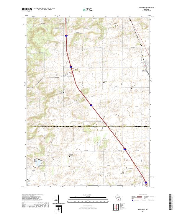
The rolling prairie of the Columbia County and Dane County border defines this 2022 survey, centered on the village of Arlington. The landscape reflects a deeply established agricultural heritage, evidenced by numerous historic burial grounds including Arlington Prairie Cem and the uniquely named One Hundred Mile Grove Cem. The village of Dane anchors the southwestern corner, connected to its neighbors by a geometric grid of rural roads like Smokey Hollow Rd and Pine Hollow Rd. This modern map maintains the precise locations of small rural landmarks like the Eberle Ranch Airport and the Arlington Evangelical Cem, providing contemporary spatial context for local historians tracing family names and property boundaries in this transition zone between two major Wisconsin counties.
Find a feature on this map
54 named features on this map. Tap any name to fly to it.
Don’t see what you’re looking for? This feature index may not catch every label — zoom into the map to look around manually.
Map Details
Editions of this 2022 Arlington Map
This is the sole edition of this map. No revisions or reprints were ever made.