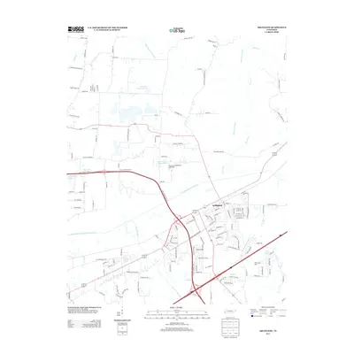
2013 Map of Arlington
USGS Topo · Published 2013About this map
Arlington serves as the primary hub of this Tennessee landscape, defined by a sophisticated network of water management features and family-named landmarks. The area is heavily marked by engineered waterways including the Loosahatchie River Canal and the Beaver Creek Canal, reflecting a history of drainage and agricultural land reclamation. Several prominent water bodies, such as Doctor H E Atherton Lake and Robert G Drewrys Lake, suggest private landownership patterns that have shaped the local geography.
Find a feature on this map
136 named features on this map. Tap any name to fly to it.
Don’t see what you’re looking for? This feature index may not catch every label — zoom into the map to look around manually.
Map Details
Editions of this 2013 Arlington Map
This is the sole edition of this map. No revisions or reprints were ever made.
Other maps of this area

1942 · Millington
USGS Topo · 1:62,500

1943 · Collierville
USGS Topo · 1:62,500

1953 · Collierville
USGS Topo · 1:50,000

1954 · Mason
USGS Topo · 1:62,500

1956 · Blytheville
USGS Topo · 1:250,000

1959 · Blytheville
USGS Topo · 1:250,000

1960 · Bartlett
USGS Topo · 1:62,500

1960 · Millington
USGS Topo · 1:62,500

1961 · Bartlett
USGS Topo · 1:62,500
1965 · Oakland
USGS Topo · 1:24,000