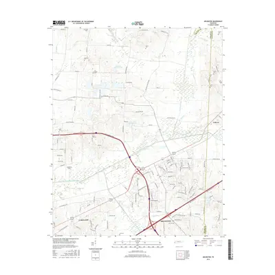
2016 Map of Arlington
USGS Topo · Published 2016About this map
Lakeland and Arlington anchor this mid-2010s survey, illustrating the modern residential development and infrastructure within the western Tennessee corridor. The landscape is defined by an extensive network of water management features, including the Loosahatchie River Drainage Canal, Clear Creek Canal, and Cypress Cr Canal, which crisscross the low-lying areas near the Shelby County and Fayette County border. The presence of numerous family and community burial grounds, such as Gratitude Cem, Mount Sinai Cem, and Oak Springs Cem, provides significant points of interest for genealogists tracking local heritage. Smaller rural landmarks like Needham's Airport and several private reservoirs, including Doctor H E Atherton Lake and Robert G Drewrys Lake, contrast with the growing suburban subdivisions and the high-speed transit routes of the Paul W. Barret Parkway and Interstate 40.
Find a feature on this map
125 named features on this map. Tap any name to fly to it.
Don’t see what you’re looking for? This feature index may not catch every label — zoom into the map to look around manually.
Map Details
Editions of this 2016 Arlington Map
This is the sole edition of this map. No revisions or reprints were ever made.
Other maps of this area

1942 · Millington
USGS Topo · 1:62,500

1943 · Collierville
USGS Topo · 1:62,500

1953 · Collierville
USGS Topo · 1:50,000

1954 · Mason
USGS Topo · 1:62,500

1956 · Blytheville
USGS Topo · 1:250,000

1959 · Blytheville
USGS Topo · 1:250,000

1960 · Bartlett
USGS Topo · 1:62,500

1960 · Millington
USGS Topo · 1:62,500

1961 · Bartlett
USGS Topo · 1:62,500
1965 · Oakland
USGS Topo · 1:24,000