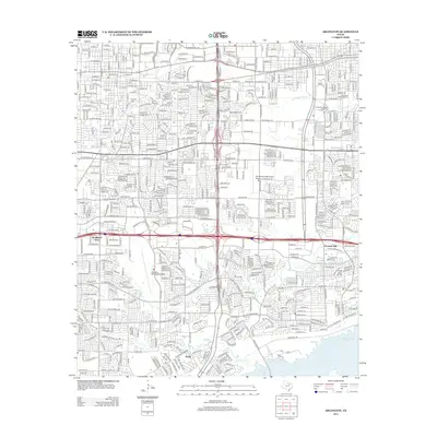
2012 Map of Arlington
USGS Topo · Published 2012About this map
The Univ of Texas at Arlington serves as a central landmark in this dense urban landscape, which shows the intense residential and commercial development of the early 21st century. The map captures a complex network of major thoroughfares including E Park Row Dr, W Arkansas Ln, and Mayfield Rd, illustrating the rapid growth connecting once-distinct communities. To the south, the expansion of the city meets the shoreline of Joe Pool Lake, where the grid of suburban streets gives way to open water and recreational space.
Find a feature on this map
50 named features on this map. Tap any name to fly to it.
Don’t see what you’re looking for? This feature index may not catch every label — zoom into the map to look around manually.
Map Details
Editions of this 2012 Arlington Map
This is the sole edition of this map. No revisions or reprints were ever made.
Other maps of this area

1891 · Dallas
USGS Topo · 1:125,000

1893 · Dallas
USGS Topo · 1:125,000

1894 · Fort Worth
USGS Topo · 1:125,000

1931 · Carrollton
USGS Topo · 1:62,500

1931 · Grapevine
USGS Topo · 1:62,500

1954 · Dallas
USGS Topo · 1:250,000

1958 · Dallas
USGS Topo · 1:250,000

1959 · Kennedale
USGS Topo · 1:24,000

1959 · Arlington
USGS Topo · 1:24,000

1959 · Euless
USGS Topo · 1:24,000
Featured Places
- Arlington, TX
- Grand Prairie, TX
- Heather Glen, Grand Prairie
- Somerton Village, Grand Prairie
- Enchanted Creek, Arlington