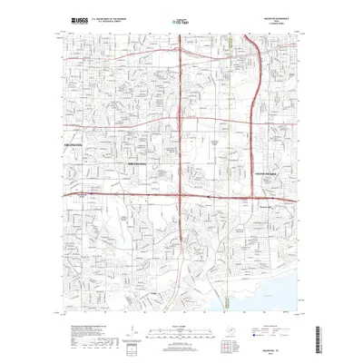
2019 Map of Arlington
USGS Topo · Published 2019About this map
Arlington and Grand Prairie anchor this heavily developed corridor in the late 2010s, bisected by the north-south President George Bush Tpke and the county line between Tarrant and Dallas counties. The landscape is a dense grid of residential and commercial expansion, yet historical markers remain at Parkdale Cem and Southland Memorial Park. Aviation is central to the area's infrastructure, evidenced by the large footprints of the Arlington Municipal Airport and Grand Prairie Municipal Airport. To the south, the terrain transitions toward the water, where Fish Cr and Lynn Cr feed into the expansive Joe Pool Lake. This reservoir, along with smaller settlements like Florence Hill and Webb, illustrates the modern suburban geography where original community identities meet massive regional water management and transit projects.
Find a feature on this map
42 named features on this map. Tap any name to fly to it.
Don’t see what you’re looking for? This feature index may not catch every label — zoom into the map to look around manually.
Map Details
Editions of this 2019 Arlington Map
This is the sole edition of this map. No revisions or reprints were ever made.
Other maps of this area

1891 · Dallas
USGS Topo · 1:125,000

1893 · Dallas
USGS Topo · 1:125,000

1894 · Fort Worth
USGS Topo · 1:125,000

1931 · Carrollton
USGS Topo · 1:62,500

1931 · Grapevine
USGS Topo · 1:62,500

1954 · Dallas
USGS Topo · 1:250,000

1958 · Dallas
USGS Topo · 1:250,000

1959 · Kennedale
USGS Topo · 1:24,000

1959 · Arlington
USGS Topo · 1:24,000

1959 · Euless
USGS Topo · 1:24,000
Featured Places
- Arlington, TX
- Grand Prairie, TX
- Heather Glen, Grand Prairie
- Somerton Village, Grand Prairie
- Enchanted Creek, Arlington