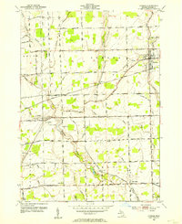
1952 Map of Armada
USGS Topo · Published 1954About this map
Armada serves as the primary hub of this Macomb County landscape, situated at the junction of the Grand Trunk railroad line and several key township roads. The 1952 culture revision reveals an agricultural region structured by an extensive network of water management, including the Armada and Ray Drain and Coon Creek. These drains and brooks define the boundaries between the townships of Bruce, Armada, Washington, and Ray.
Find a feature on this map
50 named features on this map. Tap any name to fly to it.
Don’t see what you’re looking for? This feature index may not catch every label — zoom into the map to look around manually.
Map Details
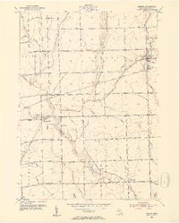
Editions of this 1952 Armada Map
2 editions found
Other maps of this area

1908 · Rochester
USGS Topo · 1:62,500

1912 · Mt Clemens
USGS Topo · 1:62,500

1914 · Armada
USGS Topo · 1:62,500

1928 · Armada
USGS Topo · 1:62,500

1929 · Mt Clemens
USGS Topo · 1:62,500

1936 · New Haven
USGS Topo · 1:31,680

1936 · Washington
USGS Topo · 1:31,680

1936 · Waldenburg
USGS Topo · 1:31,680

1943 · Romeo
USGS Topo · 1:24,000

1944 · Memphis
USGS Topo · 1:24,000